

WARREN, N.J., March 1, 2021 — (PRNewswire) — Twenty years ago, the thought of a flying camera seemed like science fiction. Especially one capable of collecting survey–grade data. Unmanned Aerial Vehicles (UAV's) or drones, as they are more commonly known, are now part of cutting-edge survey technology, and Control Point Associates Inc. is at the forefront of utilizing this technology.
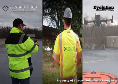
Our certified pilots and staff provide premier solutions to today's professional survey market including construction monitoring, bridge and tower inspections, tree counts, agricultural monitoring, video marketing productions, 3D modeling, and 3D topographic mapping. Control Point Associates applies traditional survey methods along with advanced photogrammetry, thermal, and lidar technology, to enhance the final products and more value to our clients.
UAVs offer an alternative to an otherwise lengthy process. Gathering ground information in hard-to-reach places, such as dense forests, can now be acquired quickly and efficiently, saving time and money. Utilizing UAV's mitigates the risk to the surveyor as the data acquisition can be carried out in a safe environment.
Control Points Associates leads the way in evolving its methods and equipment as technology advances to ensure it continues to deliver top-quality and consistent products.
Media Contact:
Andrew Demarest
(908) 668-0099
Email Contact
cpasurvey.com
![]()
![]() View original content to download multimedia:
http://www.prnewswire.com/news-releases/control-point-associates-inc-the-evolution-of-uav-capabilities-301237333.html
View original content to download multimedia:
http://www.prnewswire.com/news-releases/control-point-associates-inc-the-evolution-of-uav-capabilities-301237333.html
SOURCE Control Point Associates, Inc.
| Contact: |
| Company Name: Control Point Associates, Inc. |
