Hartley Wintney, UK, April 8th 2013 – As part of its continued expansion into Africa, Geosense, Getmapping’s wholly owned subsidiary in South Africa, has opened a new office in Centurion. The office will be the new centre of flight operations and the focus of the company’s extensive LiDAR capability. Getmapping now has three offices in Africa - Cape Town, Centurion and Nairobi.
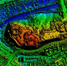
LiDAR uses a laser to measure the distance between the sensor, normally airborne, and the ground surface. The resulting highly accurate terrain map is suitable for a range of engineering applications, including infrastructure projects, such as road, rail and power transmission lines, and land based activities such as mining and planning. LiDAR is also suitable for 3D visualisation and modelling. LiDAR point clouds enable the generation of highly accurate, high resolution DEMs that facilitate the extraction of surface features based on height such as buildings, trees, and power lines. For mining applications, airborne LiDAR is a fast and inexpensive method of revealing hidden surface geology and subsurface geological structures, including faults and fractures. It also provides data for valuable subsidence monitoring, landfill volume estimates and much more.

“We have built up extensive LiDAR capabilities in South Africa to complement our existing large format digital camera capabilities and provide a full survey service to our customers, especially in the mining and power transmission sectors,” said Dave Horner, Managing Director of Getmapping. “It makes sense for us to base our LiDAR and the flight operations in an area where most of our mining and power transmission customers are also based. Our Cape Town office will continue as the production centre for much of our processing and analytical work for both Africa and the UK, and to service our customers in the Western Cape Area,” continued Horner.
-end-