Highlights:
- Assists NGA transition to innovative, transformational, cost-effective solutions
- Provides predictive analytics to continuously evaluate the health of geospatial databases
- Innovative approach extends company’s 20-year NGA partnership
MELBOURNE, Fla. — (BUSINESS WIRE) — July 10, 2018 — Harris Corporation (NYSE: HRS) has been awarded three multi-award IDIQ contracts with ceilings totaling $1.5 billion to provide the National Geospatial-Intelligence Agency (NGA) with geospatial data services for up to 10 years.
This press release features multimedia. View the full release here: https://www.businesswire.com/news/home/20180710005081/en/

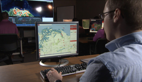
Harris will provide high-quality GEOINT information under contracts covering all three areas of NGA's JANUS program - geography, imagery and elevation. (Photo: Business Wire)
Harris will create, manage and disseminate high-quality geospatial-intelligence (GEOINT) information for use by the U.S. intelligence community and military worldwide under contracts that cover all three areas of NGA’s JANUS program – geography, imagery and elevation. The JANUS program will contribute to and maintain comprehensive, geospatially accurate databases of the world that can be accessed quickly as intelligence, operational and crisis needs arise.
Harris will use its predictive analytics technology to continuously evaluate the health of NGA databases and to guide the acquisition, creation and integration of all forms of geospatial data. Harris’ cloud-based tools will validate and correct the data – pinpointing locations that require updates.
"Winning JANUS continues our long-standing legacy of providing high-quality, responsive GEOINT and analytics to the intelligence and military communities," said Bill Gattle, president, Harris Space and Intelligence Systems. “Our analytics technology provides NGA with fit-for-purpose data, reduced production costs and cloud-based access to geospatial products and content."
Harris is investing in new technologies that improve the speed and accuracy of providing GEOINT products. The company has partnered with the NGA for almost 20 years to provide automated geospatial data processing, data management, and geospatial systems design and development. Harris provides high resolution geospatial data content and products under NGA’s Foundation GEOINT Content Management program, and previously supported the Global Geospatial-Intelligence program.
About Harris Corporation
Harris Corporation is a leading technology innovator, solving customers’ toughest mission-critical challenges by providing solutions that connect, inform and protect. Harris supports government and commercial customers in more than 100 countries and has approximately $6 billion in annual revenue. The company is organized into three business segments: Communication Systems, Electronic Systems and Space and Intelligence Systems. Learn more at harris.com.
Forward-Looking Statements
This press release contains forward-looking statements that reflect management's current expectations, assumptions and estimates of future performance and economic conditions. Such statements are made in reliance upon the safe harbor provisions of Section 27A of the Securities Act of 1933 and Section 21E of the Securities Exchange Act of 1934. The company cautions investors that any forward-looking statements are subject to risks and uncertainties that may cause actual results and future trends to differ materially from those matters expressed in or implied by such forward-looking statements. Statements about the value or expected value of orders, contracts or programs and about technology capabilities are forward-looking and involve risk and uncertainties. Harris disclaims any intention or obligation to update or revise any forward-looking statements, whether as a result of new information, future events, or otherwise.
View source version on businesswire.com: https://www.businesswire.com/news/home/20180710005081/en/
Contact:
Harris Corporation
Ellen Mitchell, 585-435-1991
Space
and Intelligence Systems
Email Contact
or
Harris
Corporation
Jim Burke, 321-727-9131
Email Contact