Waze Live Alerts on Traffic and Infrastructure Now Available in ArcGIS Marketplace
REDLANDS, Calif. — (BUSINESS WIRE) — July 10, 2018 — Esri, the global leader in location intelligence, today announced Waze live alert data will now be available in Esri's ArcGIS Marketplace for free to members of the Waze Connected Citizens Program. The Connected Citizens Program, a two-way sharing of publicly available traffic and road condition information, offers governments a stream of data, constantly updated in real-time, whenever they need it. This enables personnel to make data-driven infrastructure decisions and improves the efficiency of incident response.
This press release features multimedia. View the full release here: https://www.businesswire.com/news/home/20180710005453/en/

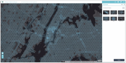
Waze live alerts on traffic and infrastructure now available in Esri ArcGIS Marketplace. (Graphic: Business Wire)
Waze, the free, crowdsourced traffic and navigation app, is now fully supported by ArcGIS Online, where its live feed of mapped traffic alerts and other information, such as accidents, congestion, and street damage, can be used in applications in minutes.
"Municipalities can now leverage near up-to-the-minute reports without having to write code or purchase additional software," said Andrew Stauffer, manager of civic technology at Esri. "Mapped Waze data is available immediately in all ArcGIS apps, where traffic engineers and even city planners can use it to maintain and build safer, more efficient transportation systems."
Municipal personnel like traffic engineers can start using this data to analyze where the biggest problems exist on the roads so they can create targeted solutions. For instance, by seeing exactly where the most crashes are occurring, engineers can know where they need to place more officers, replace street signs, or adjust the timing of traffic lights.
"The Waze Connected Citizens Program is all about removing any barriers to innovation," said Adam Fried, Waze Global Partnerships manager. "We want to help our partners leverage existing infrastructure and be able to make better data-driven decisions. Now, with just a couple of clicks, a city can easily access and analyze Waze data within Esri ArcGIS and use those insights to improve roadway management and build safer roads for its citizens."
Much of the information government organizations rely on to make decisions is becoming obsolete as communities are starting to use technology like sensors and drones to monitor the quality of roads, bridges, and utilities. The Waze Connected Citizens Program gives municipalities the power to harness crowdsourced driver data to not only improve safety and congestion but also make better-informed decisions by giving planners an edge to start building infrastructure that meets the demands of a twenty-first-century city.
Governments can sign up for the free Waze Connected Citizens Program and start working with the alert data in ArcGIS to create operational dashboards that departments can use right away.
To learn more about the newly available Waze live alert data in ArcGIS Marketplace, visit go.esri.com/waze.
About Esri
Esri, the global market leader in geographic information system (GIS) software, offers the most powerful mapping and spatial analytics technology available. Since 1969, Esri has helped customers unlock the full potential of data to improve operational and business results. Today, Esri software is deployed in more than 350,000 organizations including the world's largest cities, most national governments, 75 percent of Fortune 500 companies, and more than 7,000 colleges and universities. Esri engineers the most advanced solutions for digital transformation, the Internet of Things (IoT), and location analytics to inform the most authoritative maps in the world. Visit us at esri.com.
Copyright © 2018 Esri. All rights reserved. Esri, the Esri globe logo, The Science of Where, ArcGIS, esri.com, and @esri.com are trademarks, service marks, or registered marks of Esri in the United States, the European Community, or certain other jurisdictions. Other companies and products or services mentioned herein may be trademarks, service marks, or registered marks of their respective mark owners.
About Waze
Waze is the social navigation pioneer, leveraging mobile technology and a passionate global community to redefine expectations of today's maps. Waze is home to the world's largest network of drivers who work together daily to outsmart traffic and save time and money. The app consistently recommends the fastest routes based on real-time driving and data from millions of users. From traffic reroutes to low gas price alerts and relevant offers from favorite brands, Waze is one of the most comprehensive driving companions in the marketplace.
View source version on businesswire.com: https://www.businesswire.com/news/home/20180710005453/en/
Contact:
Esri
Karen Richardson
Public Relations
Mobile:
914-841-3180
Email:
Email Contact