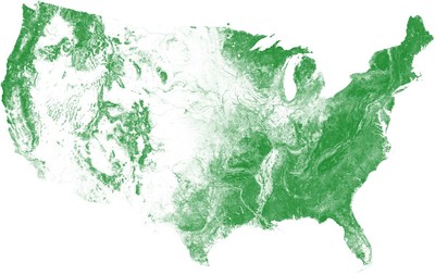
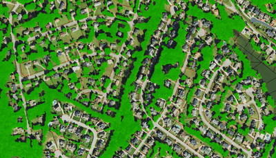
The US Tree Map seamlessly maps tree cover with an overall accuracy exceeding 96%. The data will be a continually updated to maintain a 'live' snapshot of the nation's trees. EarthDefine will acquire and process new aerial imagery every year, to keep track of the ever-changing tree cover in the U.S. at an unprecedented scale and precision.
EarthDefine used AI to process over 120 terabytes of 0.6-meter resolution National Agriculture Imagery Program (NAIP) aerial imagery to create the US Tree Map. The advantages of using such state-of-the-art AI is clear where trees need to be consistently classified across the vast and diverse geography of the continental US.
"We are seeing a lot of attention being paid to our Nation's trees and forests," said EarthDefine CEO, Vikalpa Jetly. "From rapidly changing forest cover due to the effects of wildfire, to the increased awareness of how trees benefit urban communities – people are interested in understanding and taking inventory of trees across the country." EarthDefine's US Tree Map can help planners assess urban tree canopy for any city in the contiguous U.S. and also support other applications like biomass estimation, wildfire risk monitoring, or quantifying ecosystem services. "We have always acknowledged the need for such large-scale and high-resolution tree data but technological challenges have historically limited the production of maps of this quality to only a few smaller regions," Jetly continues. "The revolution in AI over the last decade has helped us overcome these challenges and enabled high resolution mapping at continental scales. We are very pleased with the result, and feel strongly that this marks a huge stride in high-resolution land cover mapping."
EarthDefine plans to build additional nationwide data layers to further enhance it US land cover database. You can learn more about the US Tree Map at https://www.earthdefine.com/treemap/.
About EarthDefine
EarthDefine is focused on transforming earth sensor data into consumable geospatial information products for numerous applications in the private and government sectors. The company deploys image processing workflows that exploit advancements in artificial intelligence (AI) to big data challenges integrating multiple streams of geospatial information to create high-value products. To learn more please visit: www.earthdefine.com
Media Contact:
Taylor McDowell
256551@email4pr.com
1-800-579-5916
![]() View original content to download multimedia:
http://www.prnewswire.com/news-releases/us-tree-map-earthdefine-creates-the-most-detailed-map-of-americas-trees-301151010.html
View original content to download multimedia:
http://www.prnewswire.com/news-releases/us-tree-map-earthdefine-creates-the-most-detailed-map-of-americas-trees-301151010.html
SOURCE EarthDefine
| Contact: |
| Company Name: EarthDefine
Web: http://www.earthdefine.com |


